


Perihal Planit: Photo Planner
In this free app, the Ephemeris feature is provided as in-app purchase which will be the same as the PlanIt! Pro after the purchase. Some screenshots listed here have Ephemeris features enabled. The free version with the Ephemeris features can actually do a lot of things than you thought. It is a plan/marker file reader, a focal length estimator on the map, a DOF calculator, a panorama calculator, a map with marker features. The Ephemeris features are all inter-connected so it is hard for us to provide some ephemeris features in the free version and ask you to pay for the rest. Although we didn't provide a trial, please feel free to purchase to try it. We can refund you at any time if you don't like it.
The latest video tutorials are available at
https://www.youtube.com/watch?v=JFpSi1u0-is&list=PLTmlTTxPbBbcn1Fd1NRWTOczTY1RYEug4
===
This is a special call to landscape photographers, travel photographers, nature photographers and those who are interested in night photography, city photography, time-lapse, star-trails, milky way or astrophotography: look no more, this is the ultimate app for you - Planit. It only costs you a cup of Frappuccino but will save you tons of time and effort and a lot of gas money. Most importantly, it will make you enjoy landscape photography even more.
Ansel Adams dedicates the beginning of his first book "Taos Pueblo" to visualization. He introduced the idea of "previsualization", which involved the photographer imagining what he wanted his final print to look like before he even took the shot. Of course, there are many great photos which were taken impromptu. However, for landscape photographers, being able to previsualize the scene before going there will greatly reduce the chance of being caught unprepared and will greatly increase the chance of getting better shots.
Photographers use various tools to help them pre-visualizing the scene. Nowadays, many of those tools are phone apps. PlanIt! is an all-in-one solution that is designed to leverage the map and simulated viewfinder technologies to provide the necessary tools for photographers to pre-visualize the scene in combination with the ground subjects and the celestial objects such as the Sun, the Moon, Stars, Star-trails and Milky Way.
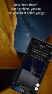
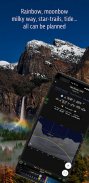
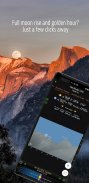
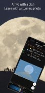
In a single app, we packed it with features - from location scouting such as GPS coordinates, elevations, distance, elevation gain, clear view, focal length, depth of field (DoF), hyperfocal distance and panorama, to the Ephemeris features such as the sunrise, sunset, moonrise, moonset time and direction, twilight time, special hours of the day, sun/moon finder, major stars, constellations, nebulae azimuth and elevation angle, star trail planning, time-lapse calculation and simulation, milky way searching, exposure/ND filter calculator, light meter, bulb timer, rainbow position prediction, tide search etc. All the information are either represented on the map as an overlay or visually presented in a simulated viewfinder (VR, picture, or street view), just like you look through your camera's viewfinder. Whatever you want for your landscape photography, it is there in the Planlt!.
Dalam aplikasi percuma ini, ciri Ephemeris disediakan sebagai pembelian dalam aplikasinya yang akan sama dengan PlanIt! Pro selepas pembelian. Beberapa tangkapan skrin yang disenaraikan di sini mempunyai ciri-ciri Ephemeris yang didayakan. Versi percuma dengan ciri Ephemeris sebenarnya boleh melakukan banyak perkara daripada yang anda pikirkan. Ia adalah pembaca fail pelan / penanda, pengukur jarak fokus pada peta, kalkulator DOF, kalkulator panorama, peta dengan ciri penanda. Ciri-ciri Ephemeris semuanya saling berkaitan jadi sukar bagi kami untuk menyediakan beberapa ciri ephemeris dalam versi percuma dan meminta anda untuk membayar yang lain. Walaupun kami tidak menyediakan percubaan, sila bebas untuk membeli untuk mencubanya. Kami boleh mengembalikan anda pada bila-bila masa jika anda tidak menyukainya.
Tutorial video terkini boleh didapati di
https://www.youtube.com/watch?v=JFpSi1u0-is&list=PLTmlTTxPbBbcn1Fd1NRWTOczTY1RYEug4
===
Ini adalah panggilan khas kepada jurugambar landskap, jurugambar perjalanan, jurugambar alam semula jadi dan mereka yang berminat dalam fotografi malam, fotografi bandar, masa berlalu, jalan bintang, jalan susu atau astrophotography: tidak lagi melihat, ini adalah aplikasi muktamad untuk anda - Planit. Ia hanya memberi anda secangkir Frappuccino tetapi akan menjimatkan banyak masa dan usaha dan banyak wang gas. Yang paling penting, ia akan menjadikan anda menikmati fotografi landskap lebih banyak lagi.
Ansel Adams mendedikasikan permulaan buku pertamanya "Taos Pueblo" untuk visualisasi. Dia memperkenalkan idea "previsualization", yang melibatkan jurugambar membayangkan apa yang dia mahu cetakan terakhirnya kelihatan seperti sebelum dia mengambil gambar. Sudah tentu, terdapat banyak foto hebat yang diambil secara tidak sengaja. Walau bagaimanapun, untuk jurugambar landskap, dapat meninjau keadaan sebelum pergi ke sana akan mengurangkan kemungkinan ditangkap tidak bersedia dan akan meningkatkan peluang mendapatkan tembakan yang lebih baik.
Jurugambar menggunakan pelbagai alat untuk membantu mereka memvisualisasikan pemandangan. Kini, banyak alat itu adalah aplikasi telefon. PlanIt! adalah penyelesaian semua-dalam-satu yang direka untuk memanfaatkan peta dan teknologi pemidang tilik simulasi untuk menyediakan alat yang diperlukan untuk jurugambar untuk pra-memvisualisasikan tempat kejadian dalam gabungan dengan subjek-subjek dan objek angkasa seperti Matahari, Bulan, Bintang, Jalan Bintang dan Bima Sakti.
Dalam satu aplikasi, kami mengemasnya dengan ciri-ciri - dari pengimbasan lokasi seperti koordinat GPS, ketinggian, jarak, kenaikan ketinggian, paparan yang jelas, jarak fokus, kedalaman medan (DoF), jarak hyperfokal dan panorama, ke ciri-ciri Ephemeris seperti matahari terbit, matahari terbenam, bulan terbit, waktu dan arah bulan, waktu senja, jam khas hari, penemu matahari / bulan, bintang utama, buruj, nebulae azimuth dan sudut ketinggian, perancangan jejak bintang, pengiraan masa lapang dan simulasi, cara susu mencari, pendedahan / kalkulator penapis ND, meter cahaya, pemasa mentol, ramalan kedudukan pelangi, pencarian pasang surut dan lain-lain. Semua maklumat sama ada ditunjukkan di peta sebagai lapisan atau visual dibentangkan dalam pemidang tilik simulasi (VR, gambar atau paparan jalan) , sama seperti anda melihat melalui pemidang tilik kamera anda. Apa sahaja yang anda mahukan untuk fotografi landskap anda, terdapat di Planlt !.
Planit: Photo Planner - Versi 10.5.1
(20-02-2024)
Planit: Photo Planner - Maklumat APK
Versi APK: 10.5.1Pakej: com.yingwen.photographertoolsAplikasi dalam kategori sama
Anda juga mungkin suka...


